
As a home or property owner, you may need to inspect your land.
What is the cost of the topographic survey?
Surveys are most often used to find the boundary or edges of your land or property by marking all four corners. They can also be used to locate sloping floodplains, determine terrain, and find locations for septic tanks or oil wells.
Most owners conduct topographic surveys prior to any transaction or project. This may mean having an inspection done before selling the property, building a fence, or putting up a new building.
Laws indicate how close to a boundary line you can build, drill, or excavate, so an accurate topographic survey ensures that you are following the correct rules.

How much does it cost to survey land?
How much does a topographic survey cost?
Landowners report that the average cost of the land survey is $ 500. This includes the price of hiring a surveyor, which ranges from $ 350 to $ 700.
The total depends on the size, location, and property as well, and some properties cost $ 1,000 or more.
These topographic surveys effectively give you a legal description of the exact boundaries of where your property boundaries begin and end.
They can save a lot of trouble and money in case of disputes because they are legally binding and professionally certified.
Boundary survey cost
Many factors influence the cost of your land survey, including the type of topographic survey, the size, boundaries, and shape of the property, the terrain, and the difficulty of accessing the property.
With these variations, the national average cost ranges from $ 500 to $ 1,200. For most homeowners, a land survey conducted for mortgage purposes on a standard-size lot costs $ 600.
You can do a single boundary inspection in a well-kept yard, working with existing deeds for about $ 400. A multi-acre parcel with four new boundary markers and a topographic drawing costs about $ 6,000.
Topographic survey vs boundary survey
A land survey clearly defines the boundaries and topography of the property, including GPS coordinates, measurements for each side, location, and any road that touches the property line.
In addition to a written description of the property, a land survey has the street address, the location of the building and adjacent properties, and even details of any improvements to the land that an owner may make.
In summary, a property topographic survey includes:
- Precise borderlines of the property.
- Specific locations of structures, additions, and improvements.
- Geographic characteristics (slope, floodplain, etc.) that affect land use.
- The location of easements, public services, and right of way.
A boundary survey is an important component of pre-construction due diligence. Boundary study establishes the perimeter of a property in relation to the legal description of a site. The partner’s licensed surveyors will review the recorded documents and perform a physical inspection to determine the physical boundaries of the site.
How much does a land survey cost?
The national average cost to purchase a topographic survey ranges from $ 350 to $ 700, with most homeowners spending approximately $ 500. The final price depends on factors such as the complexity of the terrain, the size and shape of the plot, the type of study of the land and the location of the property.
why are land surveys so expensive?
Some of these factors increase the cost:
- Surveying: Surveyors often charge a premium for land that is more difficult to access or navigate. These could be properties on a slope or those with many trees or a fence.
- Parcel Size: Since surveyors charge per acre, the larger the property, the higher the cost of surveying.
- Property Research: Surveyors don’t just measure your land property. They also verify your historical and public information. They may add a fee depending on how much research is required to study your property.
- Land Location: Most surveyors charge for travel time to reach your property, especially if it is far away or difficult to access.
- Type of topographic survey: Basic boundary surveys cost much less than full mortgage surveys or topographic surveys.
Land survey cost calculator
By finding prices, reviews, recommendations, and other information useful for a survey or similar service, a consumer can attempt to make an informed decision about how to purchase these services.
The information available online can often be inaccurate, especially for a professional service like land surveying.
In a Google search for prices or quotes, it appears: “Nationally, the average cost to contract a land survey is approximately $ 500 with a range between $ 350 and almost $ 500.
These figures can vary greatly based on location and a host of other factors.
Land survey cost in the USA
The cost of a survey varies greatly based on location and a variety of factors that drive up the final price.
The information that stands out the most for a consumer is the “national average.”
The complexity of the survey will determine the exact cost.
The price of a topographic survey depends in the first place on the state where you reside (Kansas is not the same as New York), if it is an urban area or the countryside, etc.
Websites show a national average cost of a topographic survey and lead the customer to have unrealistic expectations of the final cost.
Residential land surveyor
When websites claim that the average cost of a survey is $ 700, or that a typical price range is $ 400-500, some consumers may not stop to think about where these sites got these numbers, or Most importantly, what quality of survey work would this price tag carry.
The lowest price is not necessarily the best investment for a consumer who needs an earth survey.
Price is sometimes a priority, but it is also important for a customer to consider:
- responsiveness
- fast service
- the proper license
- the right insurance
- Constant comunication
Ultimately, a professional surveying company is the best resource for this information. Consumers are free to compare prices and consult several different sources, but only qualified professionals will be able to offer them a realistic pricing proposal.
Unlike what can be found on web pages, a professional proposal is not simply an informed guess about what a job will cost.
Professional surveyors consider job size, time constraints, engineering needs, customer needs, and other factors when preparing a survey proposal or budget.
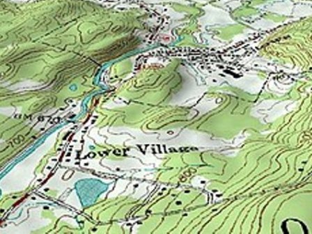
What is a Topographic survey?
A topographic survey, also known as a location or property survey, is a professional drawing that outlines the exact boundaries of your property.
It also includes the exact dimensions and location of your home, any structures, or facility additions. Additionally, it can include all fence locations, elevation, or topographic details.
Simply put, a land survey is a written legal document that reflects the graphical representation of a parcel of land.
Types of Topographical Survey
While most people think of land surveys in the most basic sense, that is, the drawing of the boundaries of a property, there are actually many different ways of surveying that service many different industries.
Types of topography
Topography is the study of the shape and features of land surfaces. The topography of an area could refer to the surface shapes and features themselves, or a description.
Land Survey Cost
- How much does a land survey cost?
- What is included in a land survey?